Northeast India refers to the easternmost region of India consisting of the contiguous Seven Sister States, Sikkim, and parts of North Bengal (districts of Darjeeling, Jalpaiguri, and Koch Bihar). Northeast India is ethnically distinct from the rest of India and has strong ethnic and cultural ties with Southeast Asia. Linguistically the region is distinguished by a preponderance of Tibeto-Burman languages. Strong ethnic cultures that had escaped Sanskritization in the ethnic groups of Kuki and some other tribes. That the eight states form a special category is officially recognized. The North Eastern Council (NEC)was constituted in 1971 as the nodal agency for the economic and social development of the eight states, the North Eastern Development Finance Corporation Ltd (NEDFi) was incorporated on August 9, 1995 and the Ministry of Development of Northeastern Region (DoNER) was set up in September 2001.
 Among the North Eastern states, Sikkim became an Indian protectorate in 1947 and a full state in 1975. The Siliguri Corridor in West Bengal, with an average width of 21 km to 40 km, connects the north eastern region with the rest of India. More than 2000 km of boundary is shared with other countries: including Nepal, China, Bhutan, Burma and Bangladesh.
History:
Assam:
The Assam Province (British India) is a northeastern state of India and is one of the most culturally and geographically distinct regions of the country. Assam though one of the original provinces of British ruled Indian subcontinent and present day India having its legislature that dates back to 1937, the present day Assam; had undergone numerous territory alignment changes with its state map being altered highest number of times when compared to any other provincial level changes that has happened in Independent India. Known for exquisite natural resources, geography and its important role in India's freedom struggle; Assam has its capital as Dispur, an especialized city circuit region located on the outskirts of its largest metropolis, Guwahati. Located south of the eastern Himalayas, Assam comprises the Brahmaputra and the Barak river valleys along with the Karbi Anglong and the North Cachar Hills with an area of 30,285 square miles (78,438 km²). Assam is surrounded by six of the other Seven Sister States: Arunachal Pradesh, Nagaland, Manipur,Mizoram, Tripura and Meghalaya. These states are connected to the rest of India via a narrow strip in West Bengal called the Siliguri Corridor or "Chicken's Neck". Assam also shares international borders with Bhutan and Bangladesh; and cultures, peoples and climate with South-East Asia – important elements in India’s Look East policy. Assam became a part of India after the British occupied the region following the First Anglo-Burmese War of 1824–1826.

Nagaland:


Tripura (Bengali: ত্রিপুরা Tripura) is a state in North-East India, with an area of 4,051 sq mi (10,490 km2). It is the third smallest state of India, according to area. Tripura is surrounded by Bangladesh on the north, south, and west. The Indian states of Assam and Mizoram lie to the east. The capital is Agartala and the main languages spoken are Bengali and Kokborok. It was formerly an independent Tripuri kingdom and was merged with independent India on 15 October 1949 by the Tripura Merger Agreement. It was also known as "Hill Tippera" (anglicized version of Tipra) during theBritish Raj period and has a history of over 2500 years and 186 kings.


Arunachal pradesh:

Meghalaya:


History:
After the Indian Independence from British Rule in 1947, the Northeastern region of British India consisted of Assam and the princely states of Manipur andTripura. Later independent movements such as Swatantra Tripura Committee were formed against grouping all the north eastern states under Assam. The states of Nagaland, Meghalaya and Mizoram were formed in the 1960-70s. From Shillong, the capital of Assam was shifted to Dispur, now a part of Guwahati. Shillong became the capital of Meghalaya. Most of these areas had been incorporated into mainstream India during the British Raj when colonial authorities annexed traditionally separate border states into Indian territory to form a buffer between their colony and external powers (i.e.: Assam, Manipur and Tripura in the Northeast, and Balochistan and the North West Frontier Province in the northwest). After independence in 1947, extension of the Indian state and political apparatus has been a challenge.
Much of Arunachal Pradesh is claimed by China.Sino-Indian relations degraded during the Sino-Indian War of 1962. The cause of the escalation into war is still disputed by both Chinese and Indian sources. During the war in 1962, the PRC captured much of the NEFA (North-East Frontier Agency) created by India in 1954. However,China soon declared ceasfire and due to Soviet veto in UN withdrew back to the McMahon Line and returned Indian prisoners of warin 1963.
The region is known for its unique culture, handicrafts, martial arts, and scenic beauty. Problems include insurgency, unemployment, drug addiction, and lack of infrastructure. Since the beginning of the economic liberalization in the 1990s, studies have shown that this region is lagging behind the others in terms of development.
States:
- Assam
- Nagaland
- Manipur
- Tripura
- Mizoram
- Arunachal pradesh
- Meghalaya
- Sikkim
Assam:
The Assam Province (British India) is a northeastern state of India and is one of the most culturally and geographically distinct regions of the country. Assam though one of the original provinces of British ruled Indian subcontinent and present day India having its legislature that dates back to 1937, the present day Assam; had undergone numerous territory alignment changes with its state map being altered highest number of times when compared to any other provincial level changes that has happened in Independent India. Known for exquisite natural resources, geography and its important role in India's freedom struggle; Assam has its capital as Dispur, an especialized city circuit region located on the outskirts of its largest metropolis, Guwahati. Located south of the eastern Himalayas, Assam comprises the Brahmaputra and the Barak river valleys along with the Karbi Anglong and the North Cachar Hills with an area of 30,285 square miles (78,438 km²). Assam is surrounded by six of the other Seven Sister States: Arunachal Pradesh, Nagaland, Manipur,Mizoram, Tripura and Meghalaya. These states are connected to the rest of India via a narrow strip in West Bengal called the Siliguri Corridor or "Chicken's Neck". Assam also shares international borders with Bhutan and Bangladesh; and cultures, peoples and climate with South-East Asia – important elements in India’s Look East policy. Assam became a part of India after the British occupied the region following the First Anglo-Burmese War of 1824–1826.

Nagaland:


Nagaland is a state in the far north-eastern part of India. It borders the state of Assam to the west, Arunachal Pradesh and part of Assam to the north,Burma to the east and Manipur to the south. The state capital is Kohima, and the largest city is Dimapur. The State of Nagaland has an area of 16,579 km2 with a population of 1,980,602 as per the 2011 census making it one of the smallest states of India. The State is mostly mountainous except those areas bordering Assam valley. Mount Saramati is the highest peak in Nagaland with a height of 3,840 metres and its range forms a natural barrier between Nagaland and Burma. It lies between the parallels of 98 degree and 96 degree East Longitude and 26.6 degree and 27.4 degree latitude North of the Equator.
Nagaland, the 16th State of the Indian Union, was established on 1 December 1963. It is divided into eleven districts: Kohima, Phek, Mokokchung,Wokha, Zunheboto, Tuensang, Mon, Dimapur, Kiphire, Longleng and Peren. It is a largely mountainous state. Agriculture is the most important economic activity in Nagaland. Principal crops include rice, corn, millets, pulses, tobacco, oilseeds, sugarcane, potatoes and fibres. Other economy boosters are forestry, cottage industries, insurance, real estate and tourism.
Manipur:
Manipur pronunciation (help·info) (Meitei: মণিপুর maṇipur) is a state in northeastern India, with the city of Imphal as its capital. Manipur consist of Kangleipak kingdom (piori and muslim) and the hills of the tribals and is bounded by the Indian states of Nagaland to the north, Mizoram to the south and Assam to the west; it also borders Burma to the east. It covers an area of 22,347 square kilometres (8,628 sq mi). Geographically, it falls under theSoutheast Asia region.
The Meiteis (Meeteis), who live primarily in the state's valley region, form the primary ethnic group (60% of the total population) but occupy only 10% of the total land area. Their language, Meiteilon (Meeteilon), (also known as Manipuri), is also the lingua franca in the state, and was recognized as one of the national languages of India in 1992. The Muslims (Meitei-Pangal) also live in the valley; the Kukis, Nagas, Hmars and other smaller groups form about 40% of the population but occupy the remaining 90% of the total land area of Manipur State . Manipur is considered a sensitive border state.

Tripura:
Tripura finds mentions in the Mahabharata, the Puranas and pillar inscriptions of Emperor Ashoka. Tripura has a long historic past, its unique tribal culture and a fascinating folklore.In the distant past Tripura was known as Kirat Desh.
Tripura was a princely state. The Tripuri Kings (bubagra) held the title of Manikya and ruled Tripura for 3000 years until its merger with the union of India.Udaipur, in South Tripura district, was the capital of the Kingdom. The capital was shifted to Old Agartala by King Krishna Manikya in the eighteenth century, and then to the present Agartala in the 19th Century. The 19th century marked the beginning of Tripura's modern era, when King Bir Chandra Manikya Bahadur Debbarma modeled his administration on the pattern of British India and enacted various reforms.
The Ganamukti Parishad movement led to the integration of the kingdom with India signed by the Regent Maharani on September 9, 1947 and the administration of the state was actually taken over by the Govt. of India on October 15, 1949 within Assam state. Tripura became a Union Territory without legislature with effect from November 1, 1956 and a popular ministry was installed in Tripura on July 1, 1963. On January 21, 1972 Tripura attained statehood. Tripura was heavily affected by the partition of India and the majority of the population now comprises Bangalis, many of whom came as refugees from East Pakistan after independence in 1947.

Mizoram:
Mizoram ("land of the Mizo people") is one of the Seven Sister States in North Eastern India, sharing borders with the states of Tripura, Assam,Manipur and with the neighbouring countries of Bangladesh and Burma. Mizoram became the 23rd state of India on 20 February 1987. Its capital is Aizawl.Mizoram is located in the northeast of India. The term Zomi or Mizo meaning, 'Zo People' is derived from the generic name 'Zo', the progenitor of the Zomi. They are found in northwestern Myanmar, northeastern India and Bangladesh. Anthropologists classify them as Tibeto-Burman speaking member of the Mongoloid race.Mizoram is a land of rolling hills, valleys, rivers and lakes. As many as 21 major hills ranges or peaks of different heights run through the length and breadth of the state, with plains scattered here and there. The average height of the hills to the west of the state are about 1,000 metres (3,281 feet). These gradually rise up to 1,300 metres (4,265 feet) to the east. Some areas, however, have higher ranges which go up to a height of over 2,000 metres (6,562 feet). Phawngpui Tlang also known as the Blue Mountain, situated in the south-eastern part of the state, is the highest peak in Mizoram at 2,210 metres (7,251 feet).
Arunachal pradesh:
Arunachal Pradesh is a state of India, located in the far northeast. It borders the states of Assam and Nagaland to the south, and shares international borders with Burma in the east, Bhutan in the west, and the People's Republic of China in the north. The majority of the territory is claimed by the People's Republic of China as part of South Tibet. The northern border of Arunachal Pradesh reflects the McMahon Line, a controversial 1914 treaty between the United Kingdom and a Tibetan government, which was never accepted by the Chinese government, and not enforced by the Indian government until 1950. Itanagar is the capital of the state.
Arunachal Pradesh means "land of the dawn lit mountains" in Sanskrit. It is also known as "land of the rising sun" ("pradesh" means "state" or "region") in reference to its position as the easternmost state of India. Most of the people native to and/or living in Arunachal Pradesh are of Tibeto-Burman origin. A large and increasing number of migrants have reached Arunachal Pradesh from many other parts of India, although no reliable population count of the migrant population has been conducted, and percentage estimates of total population accordingly vary widely. Part of the famous Ledo Burma Road, which was a lifeline to China during World War II, passes through the eastern part of the state.

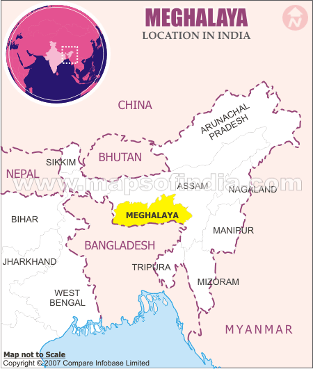
Meghalaya:
Meghalaya ( is a state in north-eastern India. The word "Meghalaya" literally means the Abode of Clouds in Sanskrit and other Indic languages. Meghalaya is a hilly strip in the eastern part of the country about 300 km long (east-west) and 100 km wide, with a total area of about 8,700 sq mi (22,720 km²). The population numbered 2,175,000 in 2000. The state is bounded on the north by Assam and by Bangladesh on the south. The capital is Shillong also known as the Scotland of the East, which has a population of 260,000.
About one third of the state is forested. The Meghalaya subtropical forests ecoregion encompasses the state; its mountain forests are distinct from the lowland tropical forests to the north and south. The forests of Meghalaya are notable for their biodiversity of mammals, birds, and plants. Meghalaya, a hilly strip in eastern India, covers a total area of just 22,429 km2. It was previously part of Assam, but on 21 January 1972, the districts of Khasi, Garo and Jaintia hills became the new state of Meghalaya.
Meghalaya is also notorious for illegal mining that is creating havoc in the state. Balpakram National Park located in South Garo Hills District is constantly being encroached as forest areas are cleared for coal mining. The Garo Hills Anti-Mining and Conservation Forum are constantly shutting these illegal mines which the government has so far simply ignored. In Jaintia Hills District illegal mining has poisoned all its rivers except for Myntang River and Umngot River. Illegal mining is a well kept secret of the state but is slowly being exposed. Recently France 24, a TV channel, exposed the used of child labor in these illegal coal mines. Local newspapers have also started to expose this dark secret of Meghalaya.
Sikkim:
Sikkim is a landlocked Indian state nestled in the Himalayas. The state borders Nepal to the west, Tibet to the north and east, and Bhutan to the southeast. The state of West Bengal borders Sikkim to its south.
With just slightly over 500,000 permanent residents, Sikkim is the least populous state in India and the second-smallest state after Goa in total area.Despite its small area of 7,096 km2 (2,740 sq mi), Sikkim is geographically diverse due to its location in the Himalayas. The climate ranges from subtropical to high alpine. Kangchenjunga, the world's third-highest peak, is located on Sikkim's border with Nepal. Sikkim is a popular tourist destination, owing to its culture, scenery and biodiversity.
Legend has it that the Buddhist saint Guru Rinpoche visited Sikkim in the 9th century, introduced Buddhism and foretold the era of the monarchy. Indeed, the Namgyal dynasty was established in 1642. Over the next 150 years, the kingdom witnessed frequent raids and territorial losses to Nepalese invaders. It allied itself with the British rulers of India, but was soon annexed by them. Later, Sikkim became a British protectorate, before merging with India following a referendum in 1975.
Sikkim has 11 official languages: Nepali (which is its lingua franca), Bhutia, Lepcha (since 1977), Limbu (since 1981), Newari, Rai, Gurung, Mangar,Sherpa, Tamang (since 1995) and Sunwar (since 1996). English is taught in schools and used in government documents. Sikkim is the only state in India with an ethnic Nepalese majority. The predominant religions are Hinduism and Vajrayana Buddhism. Gangtok is the capital and the largest town. Sikkim has a booming economy dependent on agriculture and tourism, and has the only open border between India and China.
